Lake Ontario National Marine Sanctuary Media Resources
Lake Ontario National Marine Sanctuary is America’s 16th national marine sanctuary and the third in the Great Lakes. The area encompasses 1,722 square miles of eastern Lake Ontario waters and bottomlands adjacent to Jefferson, Oswego, Cayuga, and Wayne counties in the state of New York. Lake Ontario National Marine Sanctuary celebrates the region’s maritime cultural history and provides new opportunities for research, education, recreation, and maritime heritage-related tourism in local coastal communities. The sanctuary includes a diversity of nationally significant underwater assets, including archaeological sites, shipwrecks, and submerged aircraft that embody more than two centuries of the nation’s modern history.
The images and videos below can be downloaded in high resolution and may be freely used for press purposes.

Lake Ontario National Marine Sanctuary Information Sheet
Credit: NOAA

Map of eastern Lake Ontario showing Lake Ontario National Marine Sanctuary's boundaries, which encompasses 1,722 square miles
Map: NOAA
Underwater video of the St. Peter shipwreck.
Credit: Nick Zachar/NOAA
Underwater video of the David W Mills shipwreck.
Credit: Nick Zachar/NOAA
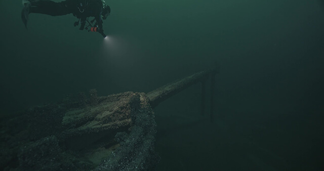
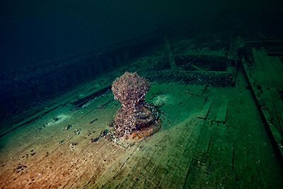
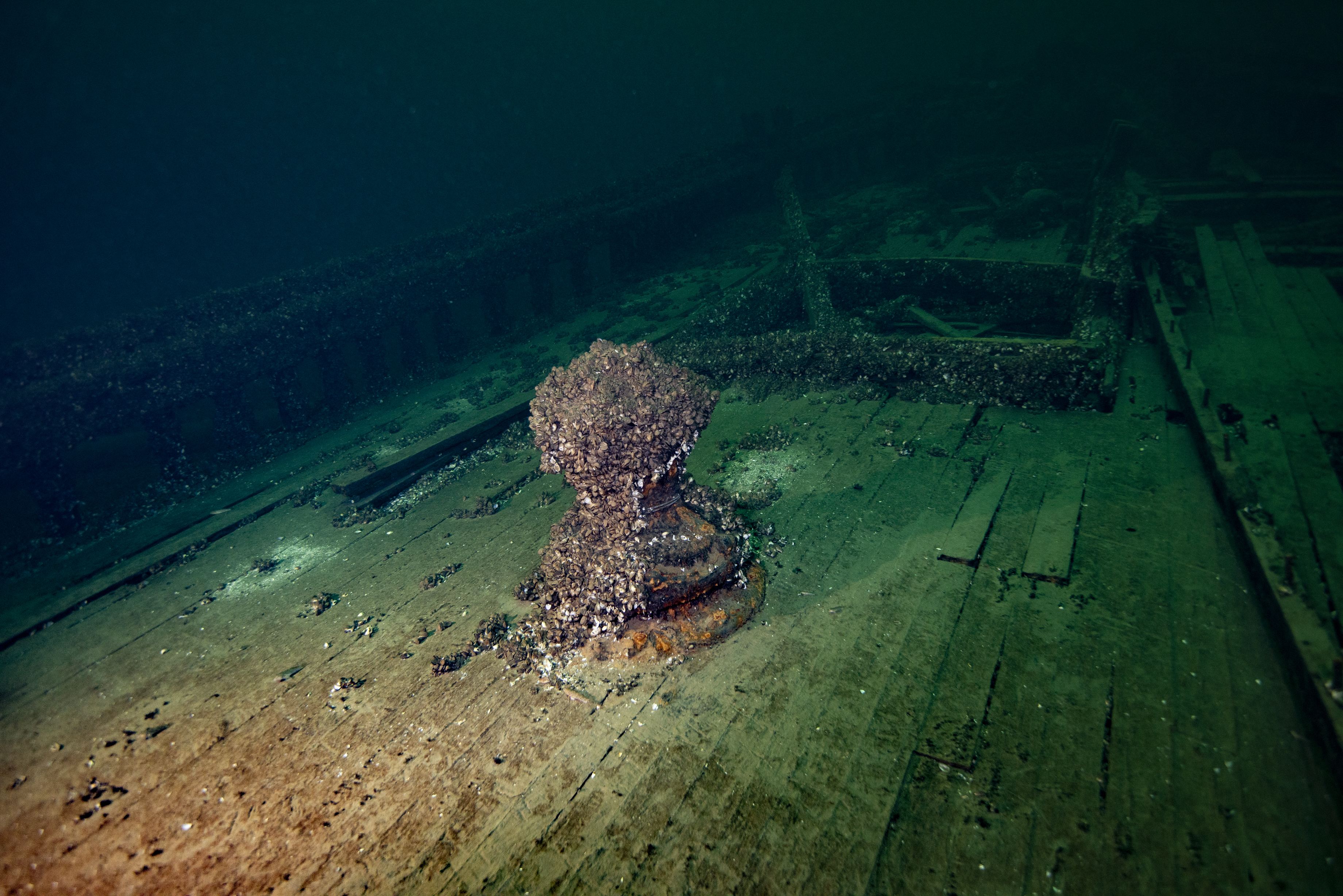
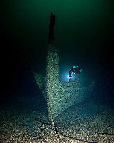
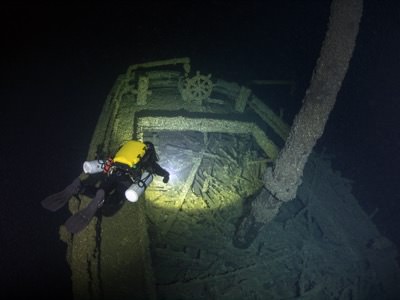
The wreck of the St. Peter
Credit: NOAA
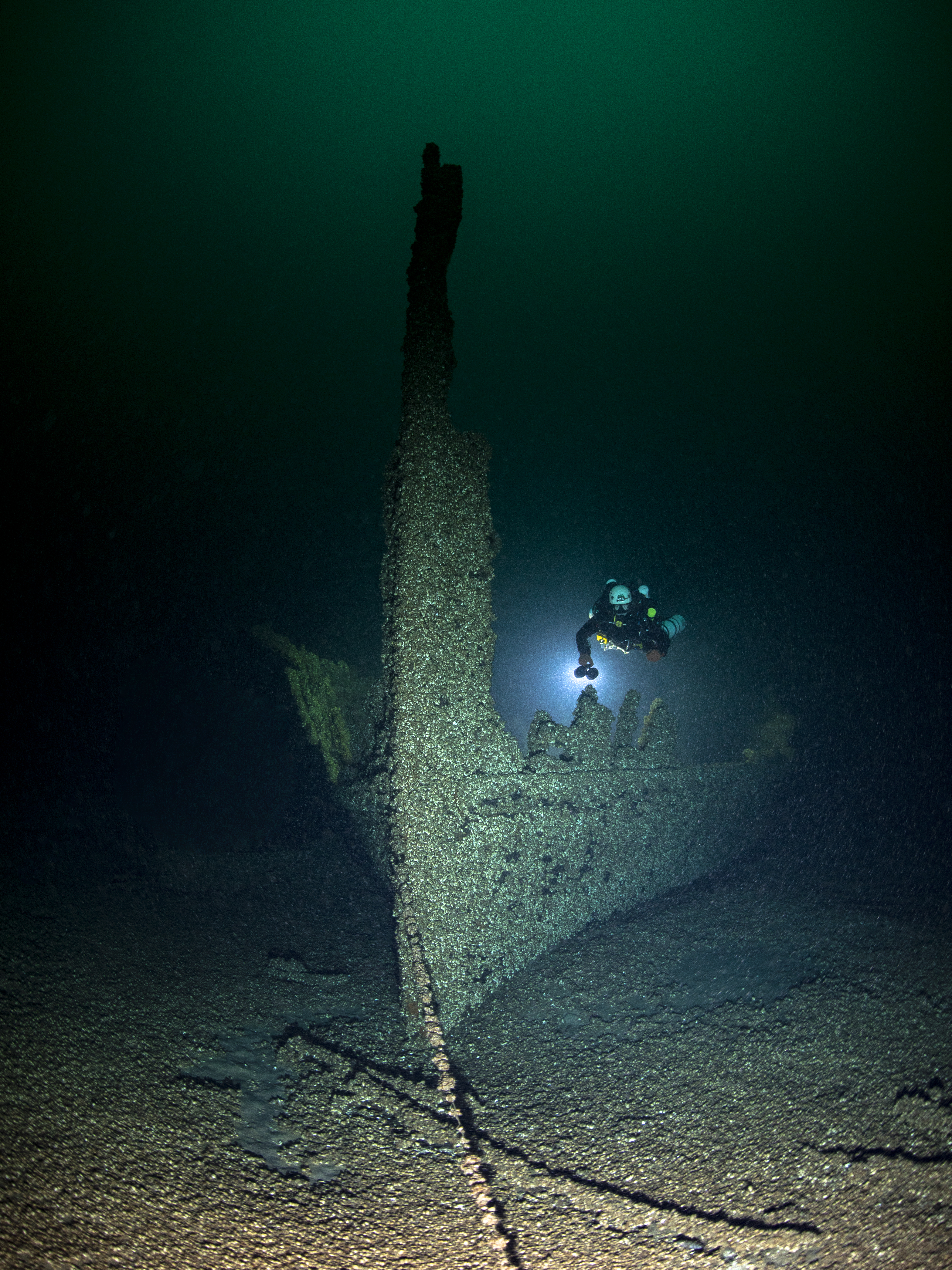
The wreck of the St. Peter
Credit: NOAA
The wreck of the St. Peter
Credit: NOAA
The wreck of the St. Peter
Credit: NOAA
The wreck of the St. Peter
Credit: NOAA
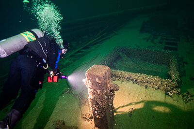
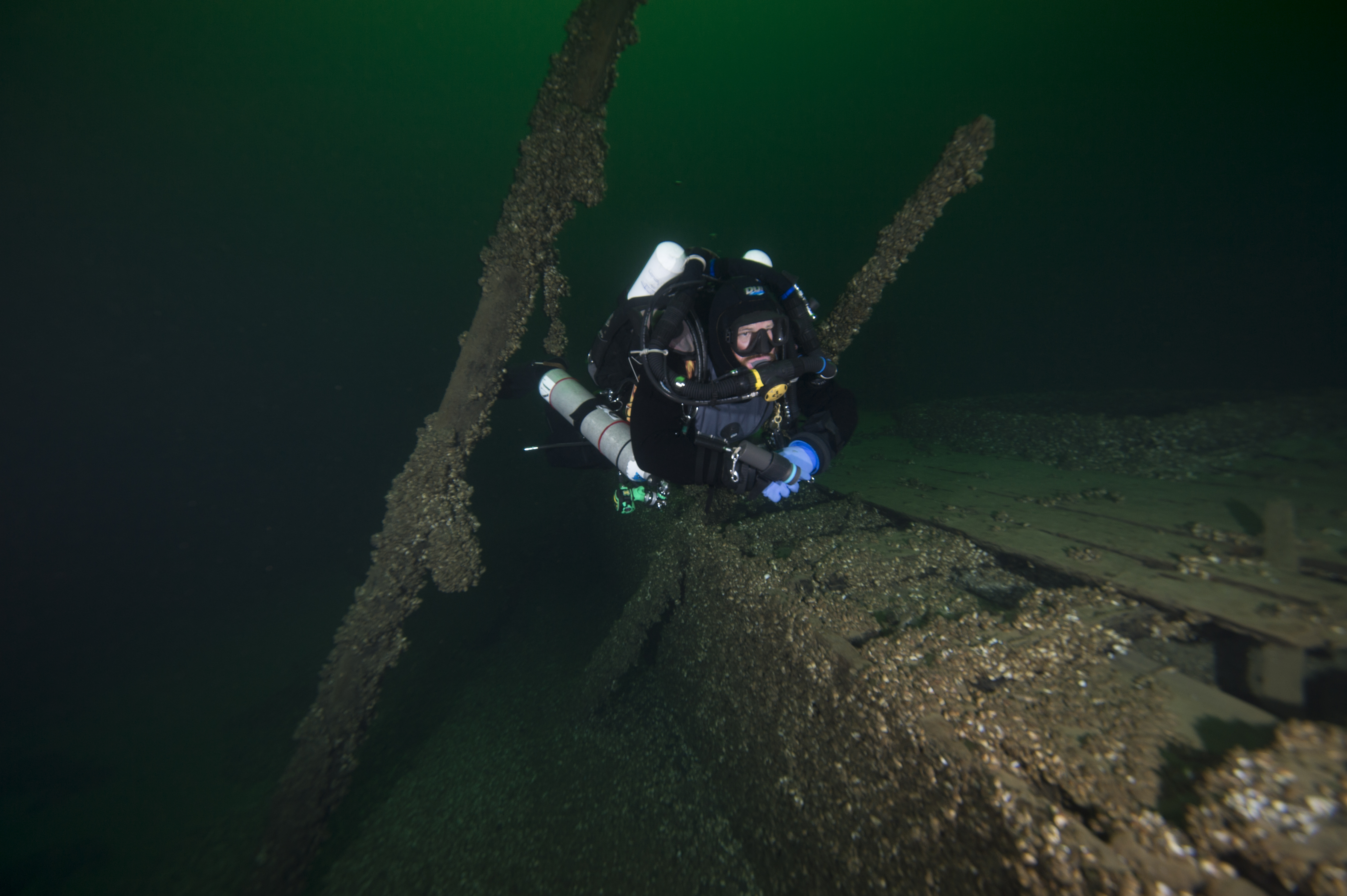
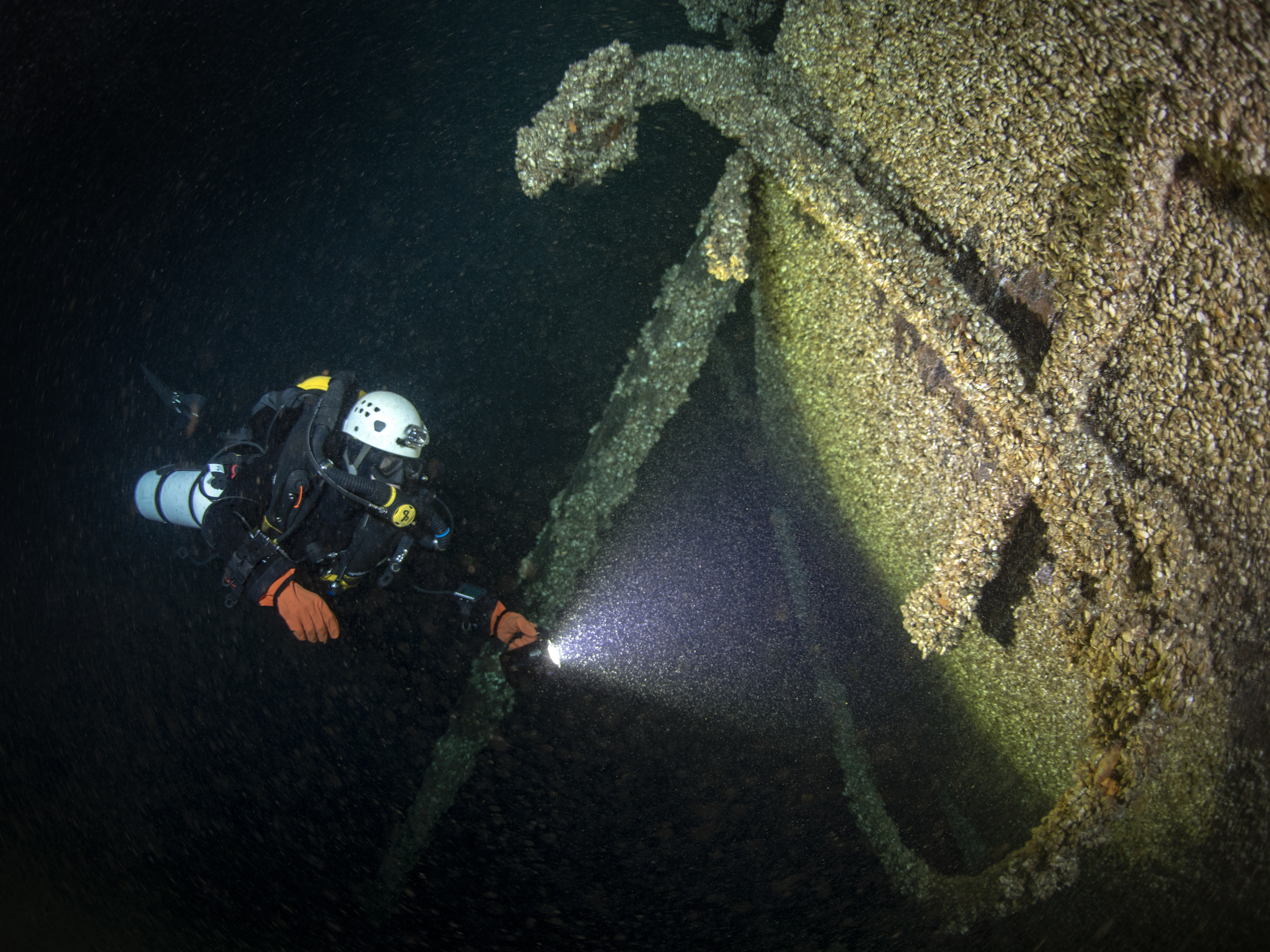
A diver swims along the wreck of the St. Peter
Credit: NOAA

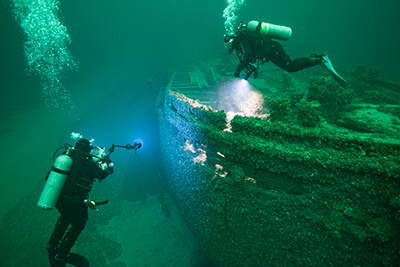
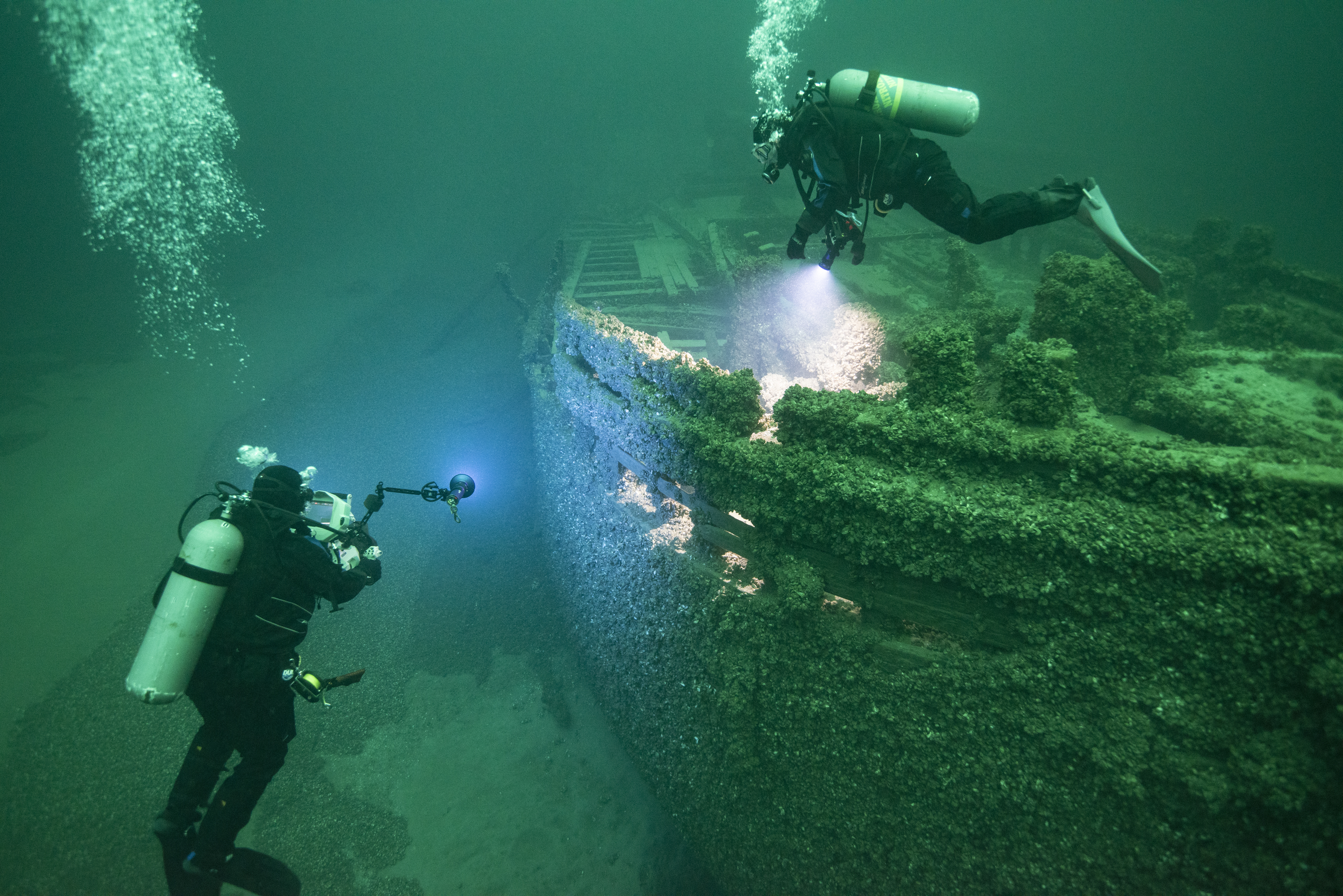
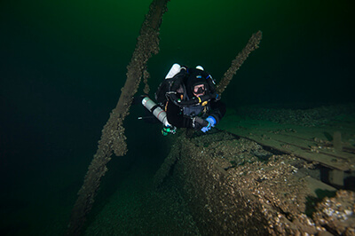
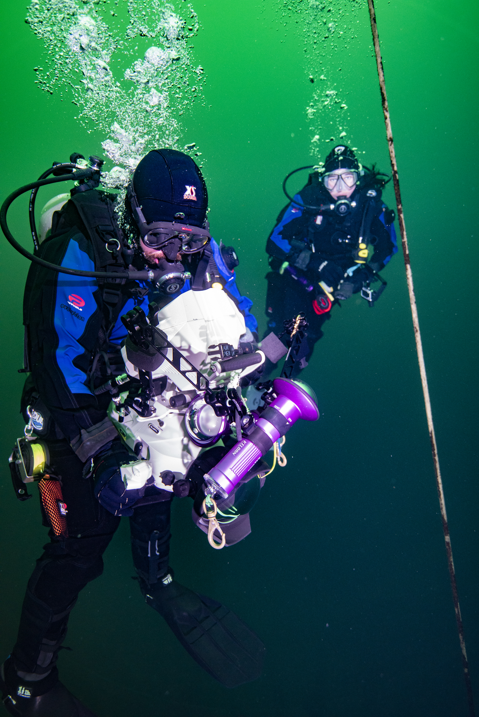
Two divers using an underwater camera
Credit: NOAA
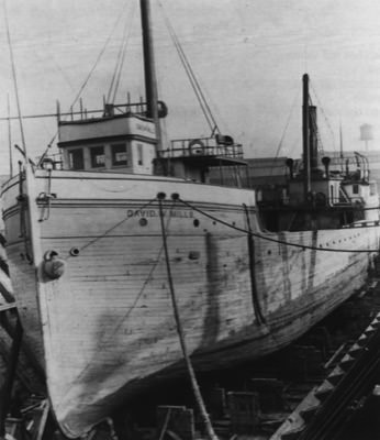
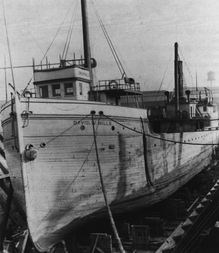
The wreck of the steamer David W. Mills, a typical 19th century cargo vessel, lies within the proposed sanctuary.
Photo courtesy of the Collection of Bowling Green State University
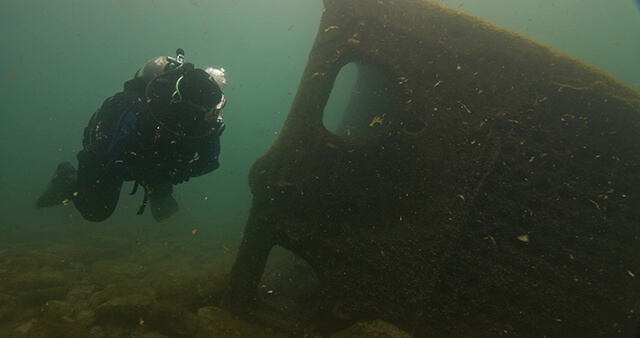
A diver inspects the bow of the suspected steamer Homer Warren.
Photo courtesy of Jill Heinerth

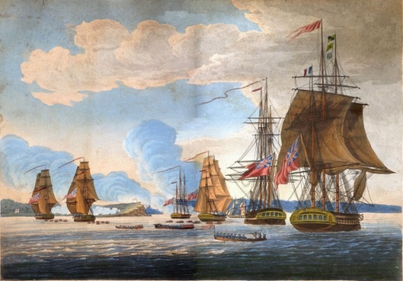
An engraving by William Steele of the British attack on Fort Oswego in 1814.
Image: William Steele, courtesy of the Collection of Paul Lear

A diver inspects the bow of Queen of the Lakes where the anchor remains in place.
Photo courtesy of Jill Heinerth
A diver explores the stern of Queen of the Lakes, which remains upright and intact with all three masts still standing after sinking with a cargo of coal in 1906.
Photo courtesy of Jill Heinerth

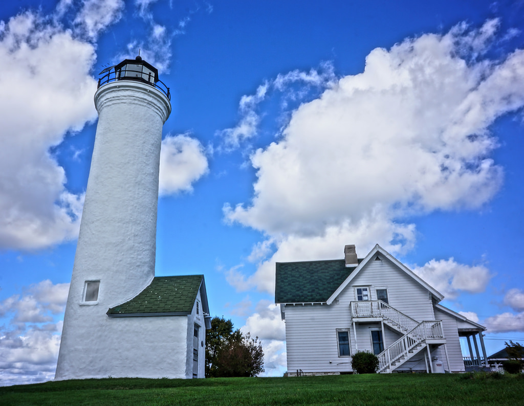
An aerial view of historic Tibbetts Point Lighthouse in the Town of Cape Vincent in Jefferson County, New York. The lighthouse marks the point where Lake Ontario meets the St. Lawrence River and overlooks the eastern boundary of Lake Ontario National Marine Sanctuary.
Photo: Matt McIntosh/NOAA

Tibett's Point Lighthouse is one of nine lighthouses within the proposed sanctuary area.
Photo courtesy of Ted Van Pelt
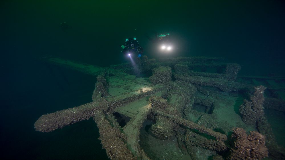
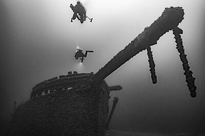
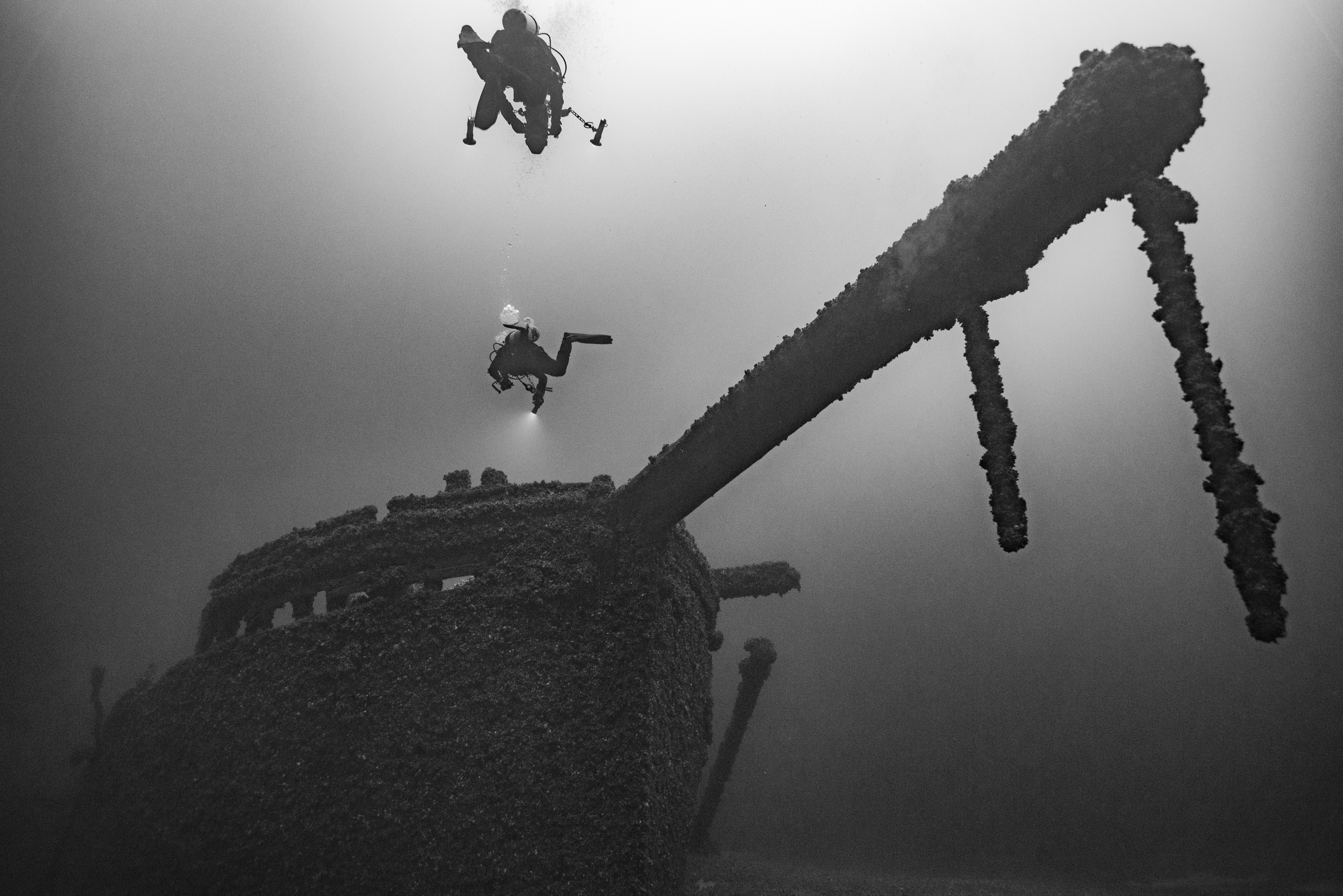
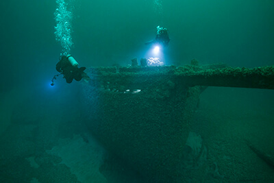
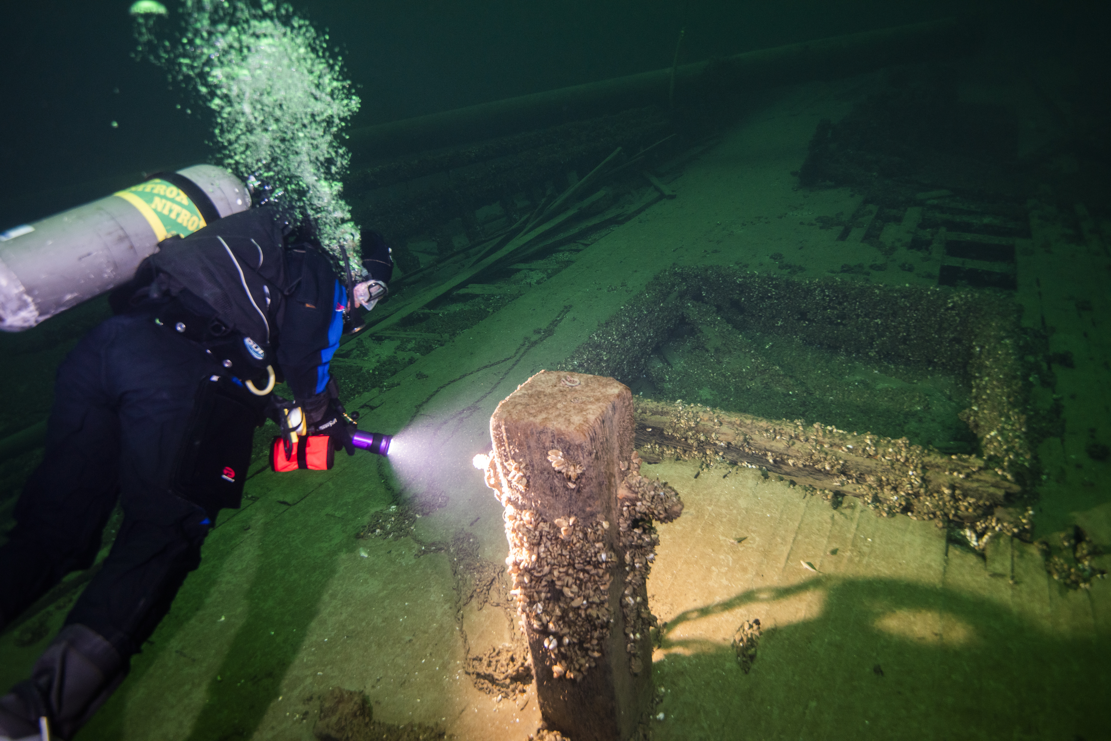
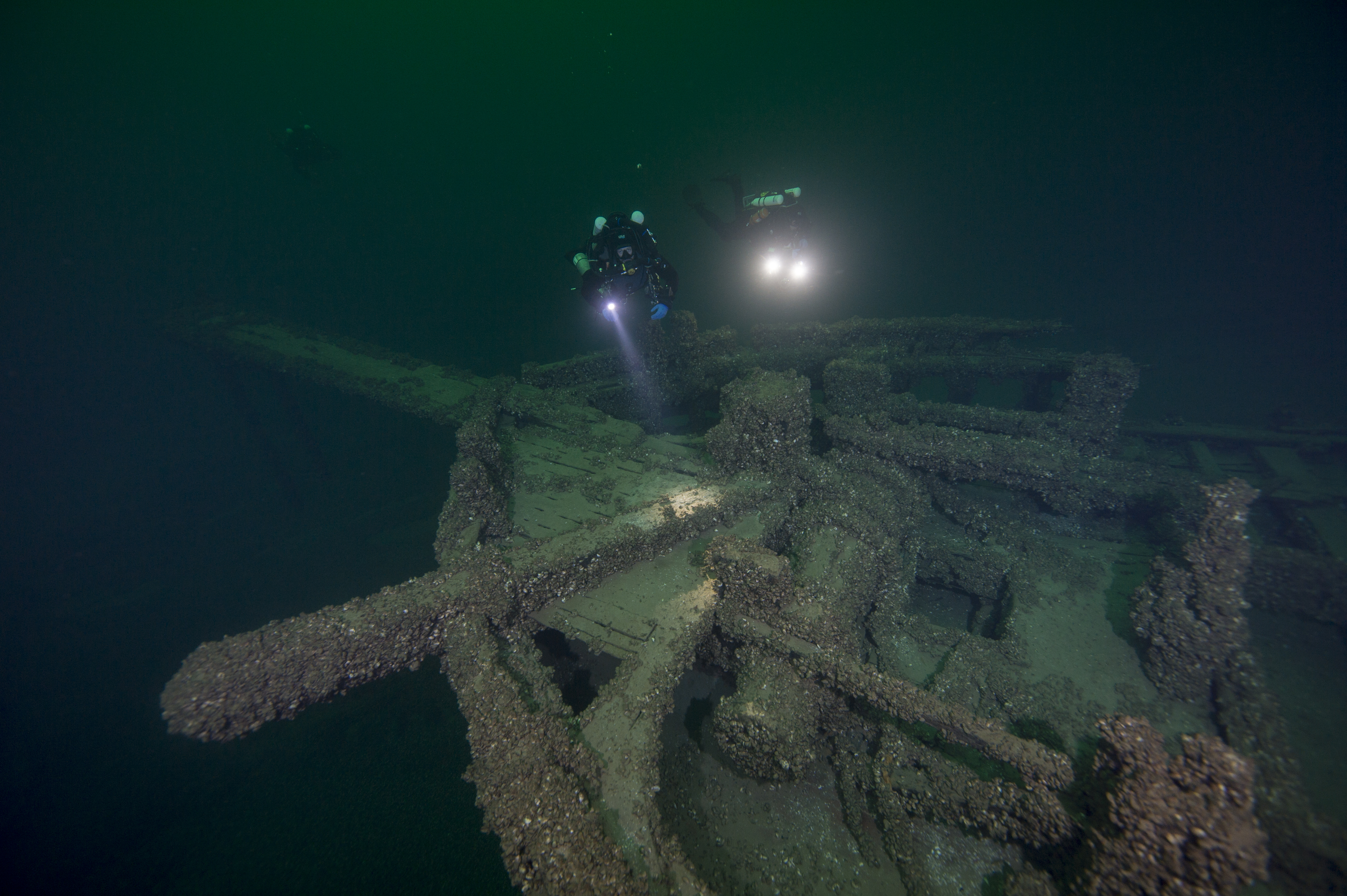
Two divers investigate the wreck of the St. Peter.
Credit: NOAA