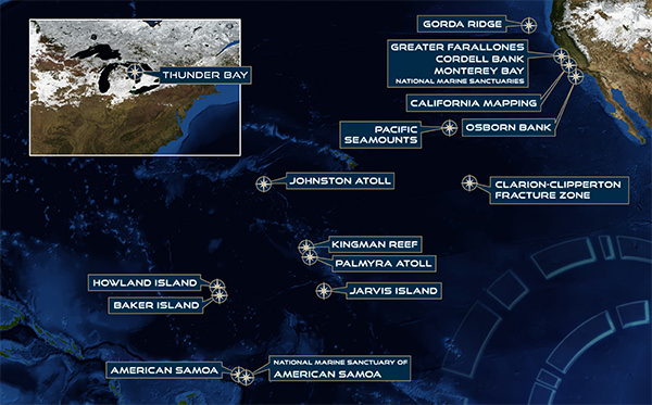
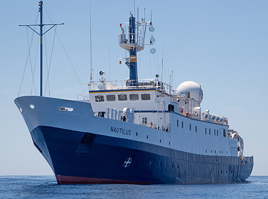
This spring, summer, and fall, NOAA's Office of National Marine Sanctuaries is teaming up with Ocean Exploration Trust to explore the marine ecosystems of the West Coast and Pacific Islands Regions. Working aboard the Exploration Vessel (E/V) Nautilus, scientists will map and explore sanctuary sites along the California coast and west to National Marine Sanctuary of American Samoa in the South Pacific.
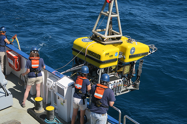
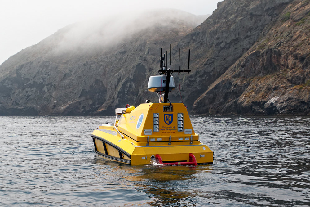
During an early mission in May in Thunder Bay National Marine Sanctuary, Ocean Exploration Trust used portable technology to explore Lake Huron. A mapping project using Autonomous Surface Vehicle (ASV) BEN supported ongoing exploration and management of Thunder Bay National Marine Sanctuary’s maritime heritage sites in May. Through Facebook Live, viewers interacted with explorers and witnessed exploration operations in real time. You can watch these recorded live interactions here.
Throughout the summer and fall, researchers will conduct mapping operations and use remotely operated vehicles (ROVs) to investigate Cordell Bank, Greater Farallones, and Monterey Bay national marine sanctuaries as well as National Marine Sanctuary of American Samoa. You can watch the livestream here.
The NOAA Office of Ocean Exploration and Research provides support for the complementary ocean exploration program of the E/V Nautilus, which operates under a similar paradigm as the NOAA Ship Okeanos Explorer.
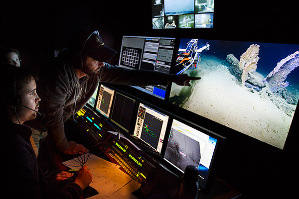
The E/V Nautilus is equipped with telepresence, which will allow scientists from around the world to participate and contribute to the success of this mission. Plus, telepresence will bring the National Marine Sanctuary System and ocean science to the classroom, as students across the country will directly engage with mission staff and operations.
For a full run-down of Ocean Exploration Trust's 2019 expedition plan and to watch live video, visit nautiluslive.org. Read on for details on the expedition's voyages into your national marine sanctuaries.
You can follow the expedition on the NOAA Office of National Marine Sanctuaries social media channels, and check back here for updates, photos, and video as the expedition continues.


Dates: May 6-17, 2019
Lead scientists: Lindsay Gee, Ocean Exploration Trust; Stephanie Gandulla, Thunder Bay National Marine Sanctuary; Jeff Gray, Thunder Bay National Marine Sanctuary; Russ Green, Thunder Bay National Marine Sanctuary
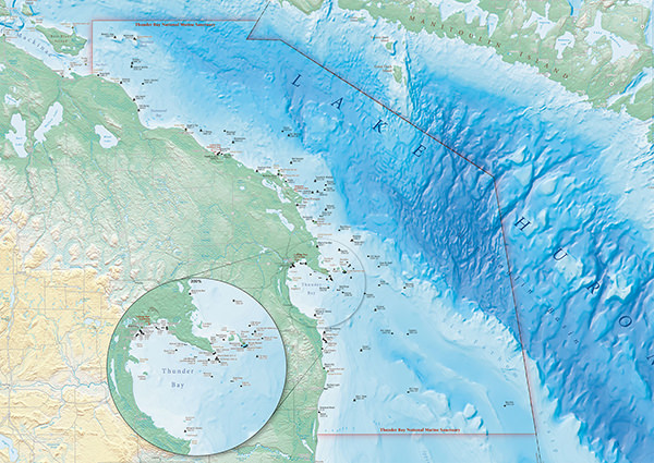
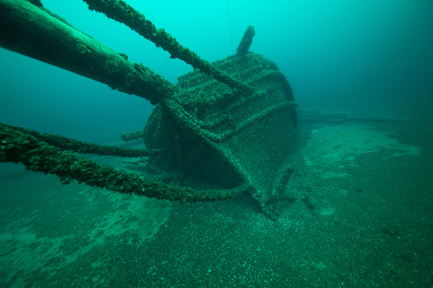
Area of exploration: Thunder Bay National Marine Sanctuary, Michigan
Located in Lake Huron, NOAA’s Thunder Bay National Marine Sanctuary was established in 2000 to protect one of the nation’s most historically significant collections of shipwrecks. In 2014, with broad public support, the sanctuary expanded from 448 to 4,300 square miles, making it the nation’s largest marine protected area (MPA) focused on underwater cultural heritage sites. Within this new boundary are 99 known shipwreck sites, while historical research indicates as many 100 additional sites in the area remain undiscovered.
This mission focuses on mapping unexplored sanctuary areas, with a goal of discovering new shipwrecks. An autonomous surface vehicle (ASV) equipped with an echosounder will be used to map target areas. The R/V Storm will be the operations platform and will also engage in mapping and surveying activities.
We brought the excitement of this project to the public through social media, an event at NOAA’s Great Lakes Maritime Heritage Center, and ship-to-shore interactions with Nautilus via Google Meets and Facebook Live.
Head to the NOAA Office of National Marine Sanctuaries Facebook page to check out these and future Facebook Live sessions, or scroll down to watch the videos on this page.
Click each image below for a larger version.
Dates: May 15-20, 2019
Lead scientists: Dr. Nicole Raineault, Ocean Exploration Trust; Jan Roletto, Greater Farallones National Marine Sanctuary; Danielle Lipski, Cordell Bank National Marine Sanctuary
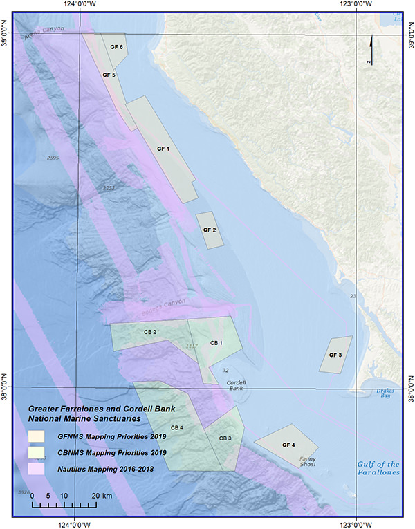
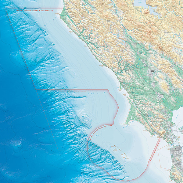
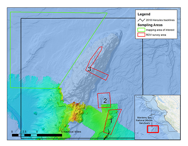
Area of exploration: Greater Farallones and Cordell Bank national marine sanctuaries
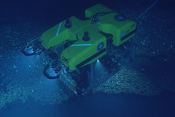
This cruise will map a number of areas within Greater Farallones and Cordell Bank national marine sanctuaries. Using the Nautilus multibeam echosounder and sub-bottom profiler, researchers will focus on several national marine sanctuary priority sites.
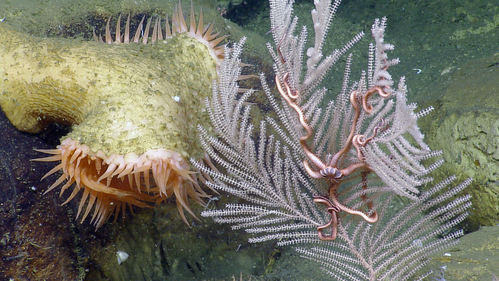
In 2015 Greater Farallones National Marine Sanctuary expanded to double in size and now protects 3,295 square miles; at the same time, Cordell Bank National Marine Sanctuary expanded from 529 to 1,286 square miles. Many areas within the expansion areas remain unmapped. These surveying efforts will continue previous years’ mapping by Nautilus to provide high resolution bathymetry and seafloor characterization. Mapping efforts will focus on waters at or below 100m (328 ft) to map previously unsurveyed areas. These mapping data will assist with planning ROV dives to take place later in the season on a second cruise.
Deep Coral Communities: Sentinels of a Changing Ocean
Deep Coral Designing Tools for Ocean Exploration
Your Earth is Blue: Protecting Maritime Heritage Resources
Greater Farallones Expedition in 60 seconds
Your Earth Is Blue: Visiting National Marine Sanctuaries Without Getting Wet
Your Earth Is Blue: Cordell Bank National Marine Sanctuary
Cordell Bank National Marine Sanctuary Expedition in 60 seconds
Dates: July 23 - August 5, 2019
Lead scientist: Dr. Christopher Roman, University of Rhode Island; Mareike Sudek, National Marine Sanctuary of American Samoa
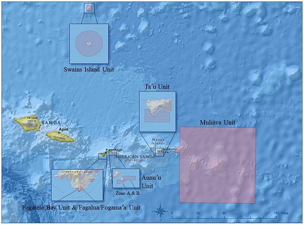
Area of exploration: American Samoa, including National Marine Sanctuary of American Samoa management areas
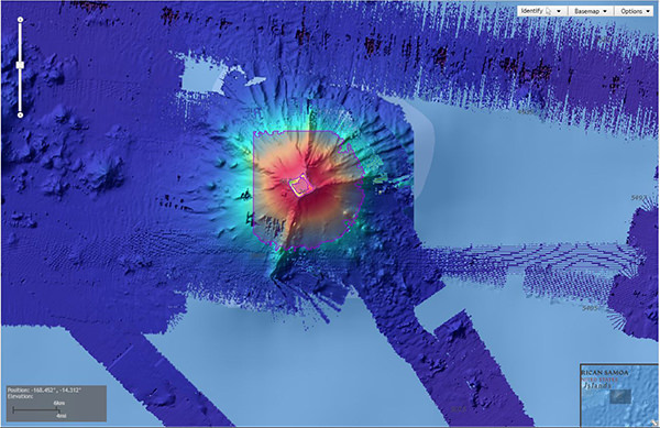
National Marine Sanctuary of American Samoa comprises six protected areas covering 13,581 square miles of nearshore coral reef and offshore ocean waters across the Samoan Archipelago. It was formerly known as Fagatele Bay National Marine Sanctuary (designated in 1986), which was established to protect 0.25 square miles of coral reef habitat in Fagatele Bay. In 2012, the sanctuary expanded to include Fagalua/Fogāma’a (the next bay east of Fagatele) on Tutuila Island, as well as areas on Aunu’u, Ta’u, and Swains islands, and Muliāva, a management area that overlays Rose Atoll Marine National Monument and includes nearby Vailulu’u and Malulu seamounts.
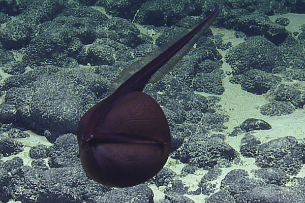
Researchers will document seafloor geology and biological communities within deep-sea habitats. Potentially-new species of deep-sea coral and subsamples of rocks will be collected to supplement the data from the 2017 NOAA Ship Okeanos Explorer expedition. Researchers will capture high-resolution photographic images of the mesophotic zone and map deep- and shallow-water seafloor areas.
Dates: October 4-11, 2019
Lead scientists: Dr. Nicole Raineault, Ocean Exploration Trust; Jan Roletto, Greater Farallones National Marine Sanctuary; Danielle Lipski, Cordell Bank National Marine Sanctuary
Area of exploration: Greater Farallones and Cordell Bank national marine sanctuaries
This expedition will visit two distinct national marine sanctuaries off the coast of California. Greater Farallones and Cordell Bank national marine sanctuaries protect one of the world’s most productive and biologically rich ocean areas, which provides habitat to more than 700 species of fish and deep benthic species.
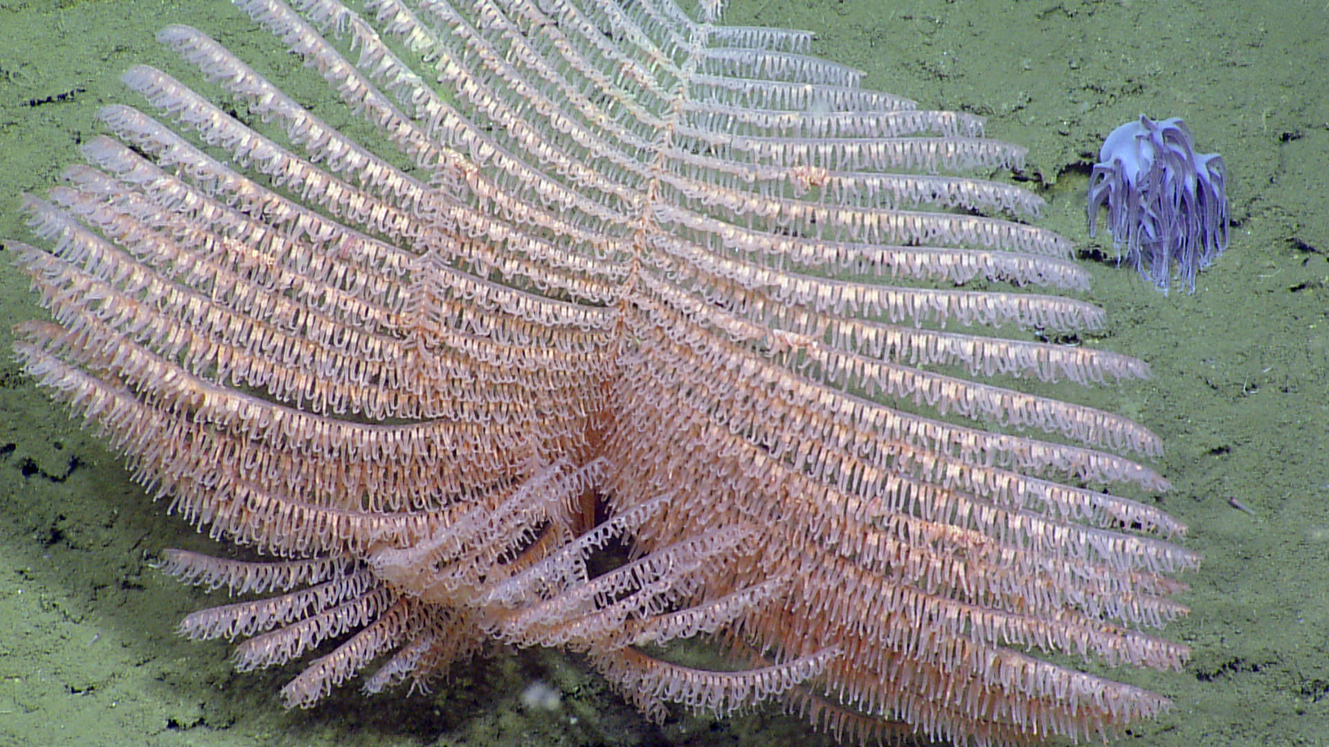
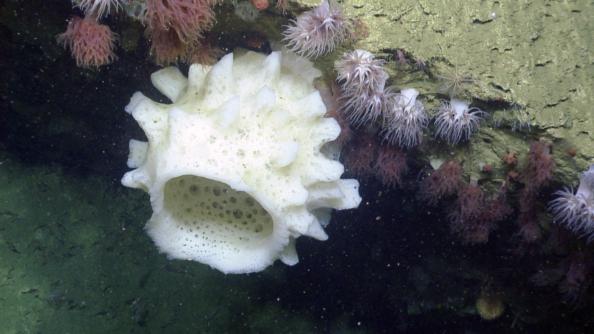
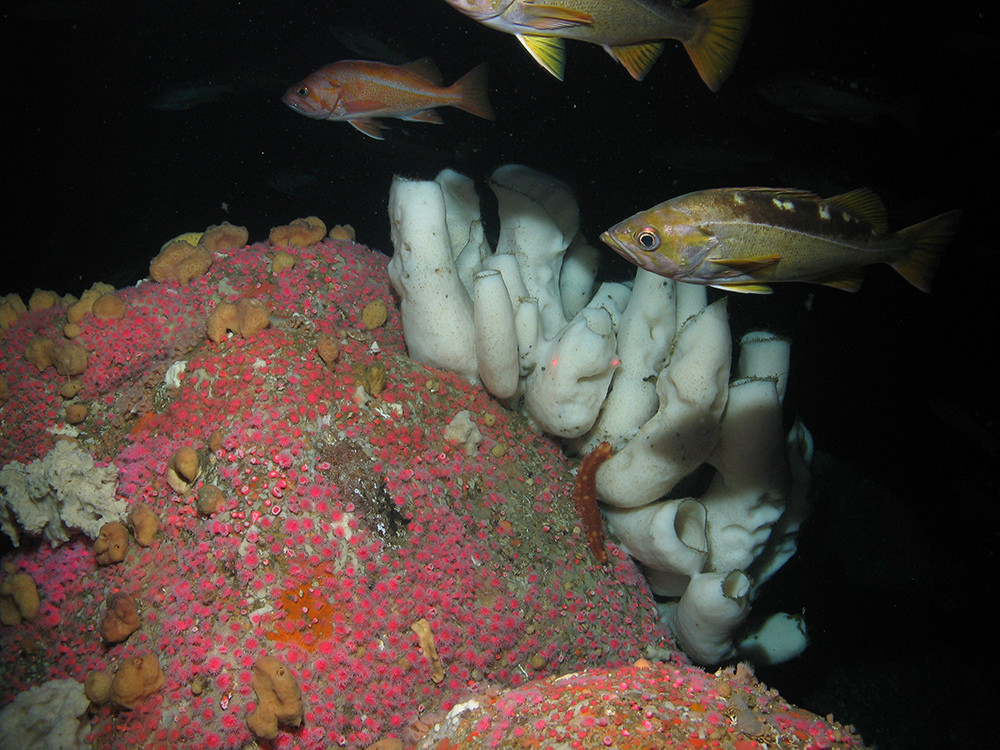
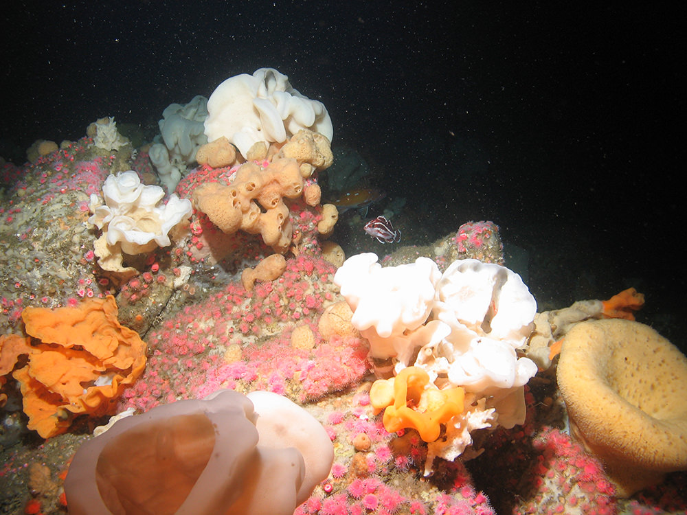
In 2015, Greater Farallones National Marine Sanctuary expanded to double in size and now protects 3,295 square miles. The expedition will visit unexplored deep-sea coral reefs. Some of these reefs lie in the deepest regions of the sanctuary and are areas that are proposed by the Pacific Fisheries Management Council to be newly opened or closed to bottom trawling starting in 2019.
Cordell Bank National Marine Sanctuary is entirely offshore and encompasses 1,286 square miles of seafloor habitat. The expedition will continue exploration of deep canyon and slope habitat begun by the sanctuary and OET in 2017. Researchers will also survey areas of Bodega Canyon that were not explored in 2017. The focus will be on deep-sea sponge and coral habitat. Notably, a new deep-sea coral species was discovered during the 2018 Ocean Exploration Trust expedition.
Deep Coral Communities: Sentinels of a Changing Ocean
Deep Coral Designing Tools for Ocean Exploration
Your Earth is Blue: Protecting Maritime Heritage Resources
Greater Farallones Expedition in 60 seconds
Your Earth Is Blue: Visiting National Marine Sanctuaries Without Getting Wet
Your Earth Is Blue: Cordell Bank National Marine Sanctuary
Cordell Bank National Marine Sanctuary Expedition in 60 seconds
Dates: October 13-18, 2019
Lead scientist: Dr. Nicole Raineault, Ocean Exploration Trust; Chad King, Monterey Bay National Marine Sanctuary
Area of exploration: Monterey Bay National Marine Sanctuary, California
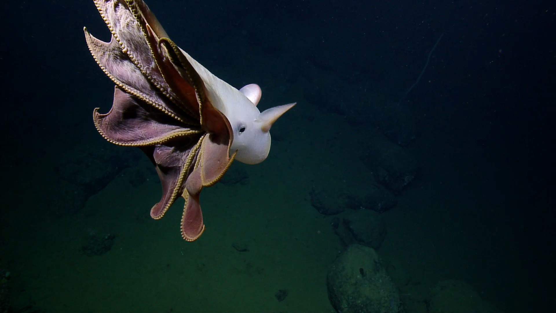
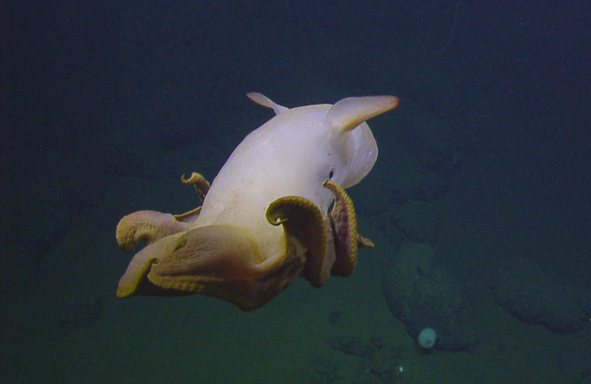
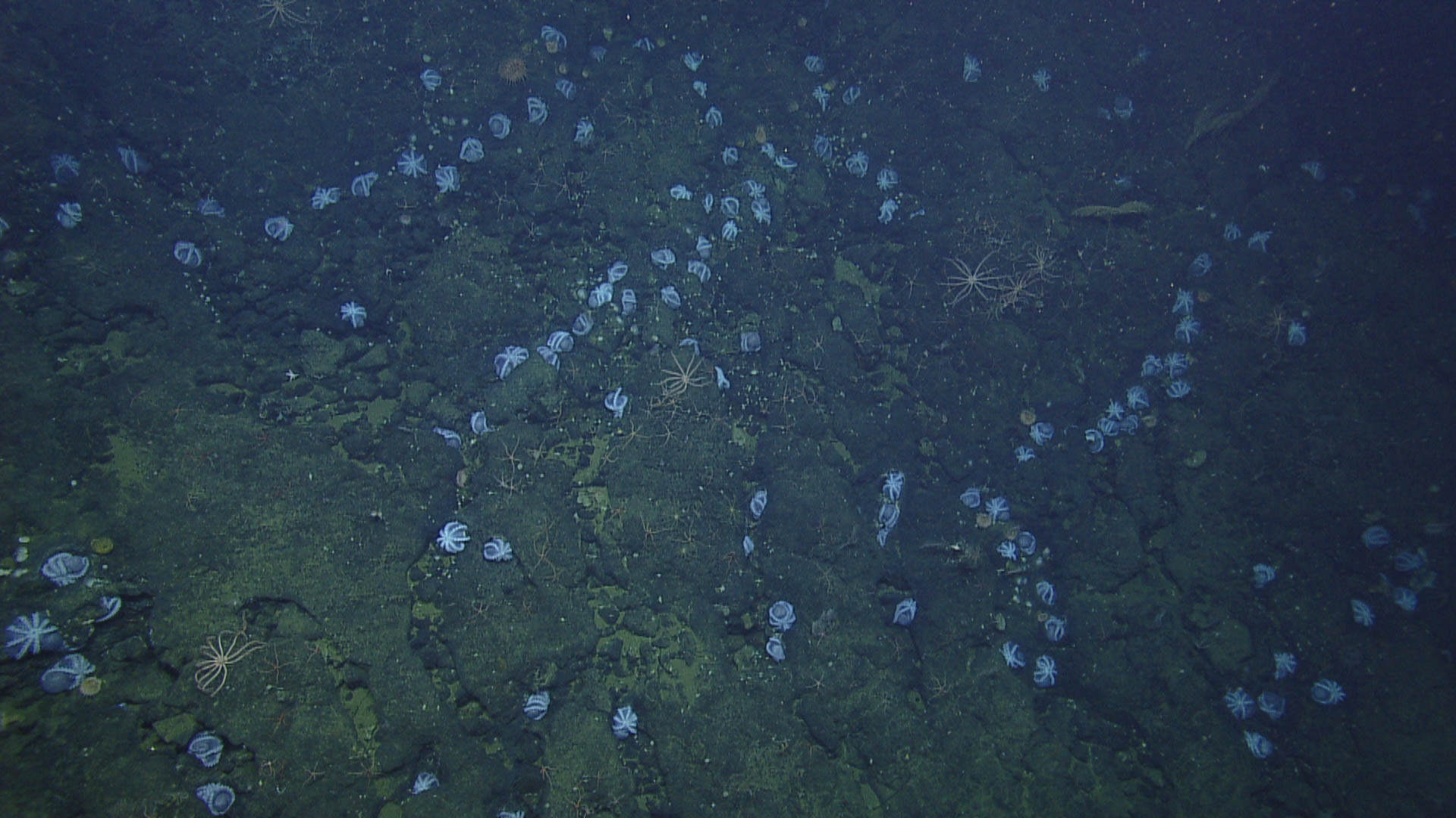
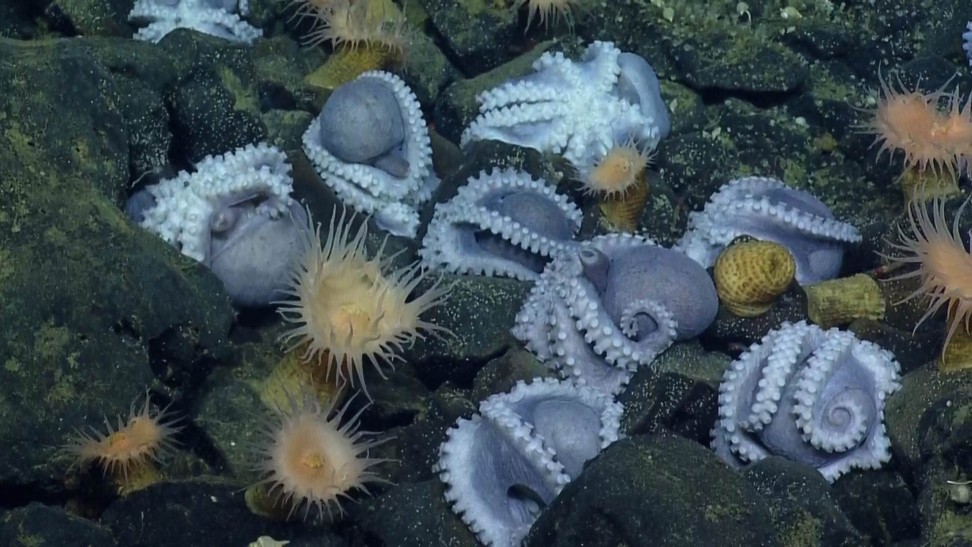
During this part of the expedition, scientists will explore and further characterize the “octopus garden,” a deep-water (>10,000 feet) region within the borders of Monterey Bay National Marine Sanctuary. In October 2018, scientists discovered extensive aggregations of over 1,000 brooding female octopuses. This area was not fully explored and will be the first objective of this cruise. A dive at the octopus garden on March 28, 2019, using the deep-diving submersible Alvin, discovered additional aggregations of 200+ brooding females and has influenced specific dive objectives. Additional goals include the characterization of corals and sponges in unexplored regions to the north of the "octopus garden."
In 2008, Davidson Seamount Management Zone was added to the area protected by Monterey Bay National Marine Sanctuary, expanding the sanctuary area by 775 square miles to a total of 6,094 square miles. Driving Davidson Seamount’s inclusion in the sanctuary was the discovery of communities of long-lived deep-sea corals and sponges during collaborative expeditions by NOAA, Monterey Bay National Marine Sanctuary, and the Monterey Bay Aquarium Research Institute in 2002, 2006, and 2007.
Tune in on the NOAA Office of National Marine Sanctuaries Facebook page on Saturday, October 12, at 4:00 p.m. PT for a Facebook Live broadcast aboard the deck of the E/V Nautilus as we begin our quest to explore Davidson Seamount in Monterey Bay National Marine Sanctuary! Learn more about the expedition, what scientists are hoping to learn, and how you can be a part of the discovery featured at NautilusLive.org from October 14-17, 2019. Take advantage of this opportunity to connect with the expedition team and ask questions through the comment section.
Click each image below for a larger version.