Ocean Exploration Trust 2022 Expedition
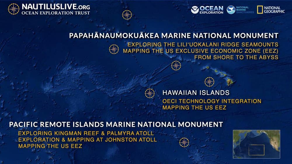
This spring and fall, Ocean Exploration Trust will explore the marine ecosystems in and around Papahānaumokuākea Marine National Monument in Hawaiʻi. The 2022 Nautilus expedition is sponsored by NOAA Ocean Exploration via the Ocean Exploration Cooperative Institute, NOAA Office of National Marine Sanctuaries, NOAA Coast Survey, National Geographic Society, and private donors.
NOAA Ocean Exploration provides additional support for the ocean exploration program of the E/V Nautilus, which operates under a similar paradigm as the NOAA Ship Okeanos Explorer.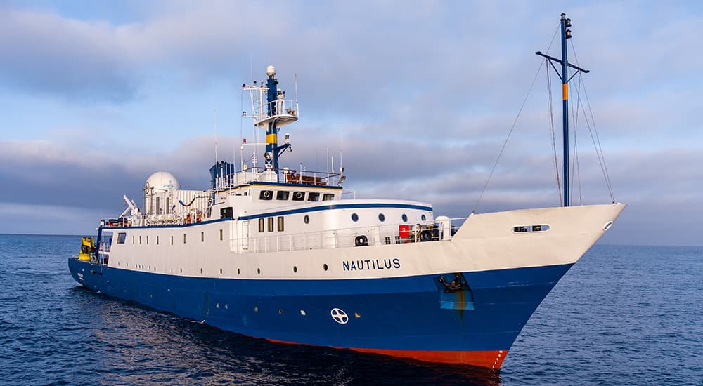
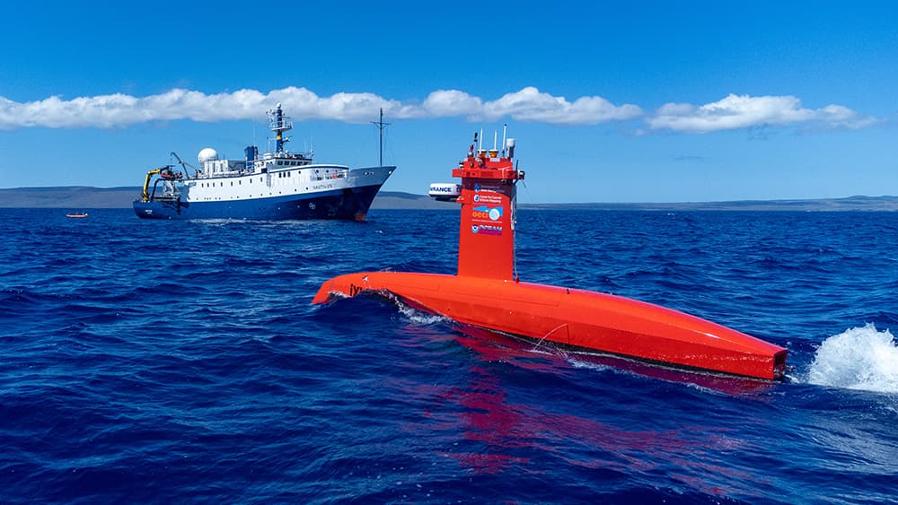
You are invited to join Ocean Exploration Trust on the 2022 E/V Nautilus expedition throughout eight months of scientific exploration in the waters of the Central Pacific Ocean near the Hawaiian Islands, around two units of the Pacific Remote Islands Marine National Monument, and throughout Papahānaumokuākea Marine National Monument. Photo: OET/NautilusLive
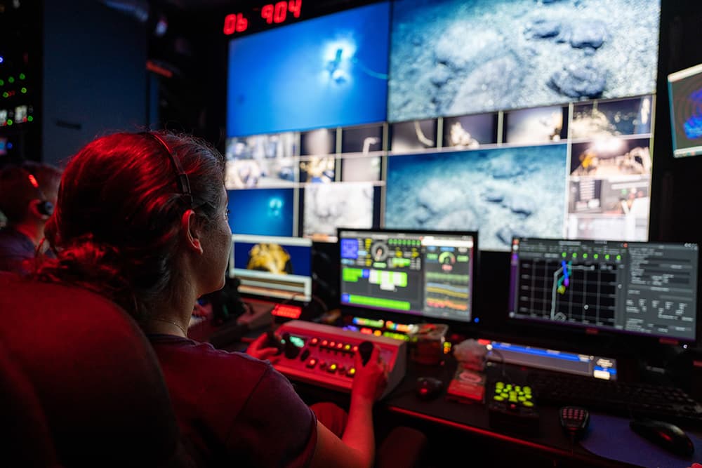
The E/V Nautilus is equipped with live streaming capabilities, which allow scientists from around the world to participate in and contribute to the success of this mission. Plus, streaming brings the National Marine Sanctuary System and ocean science to the classroom, as students across the country directly engage with mission staff and operations.
For a full run-down of Ocean Exploration Trust's 2022 expedition plan, visit NautilusLive.org. Read on for details on the expedition's voyages into Papahānaumokuākea Marine National Monument.
As we visit Papahānaumokuākea, the ancestral homeland of the Native Hawaiian people and the largest marine conservation area in the U.S., we gratefully acknowledge generations of Indigenous Hawaiians and today's stewards of these waters. OET is working closely with PMNM collaborators to inform research priorities at sea and from shore, ensure culturally grounded collection protocols, and connect with local communities through ship-to-shore connections and development of education resources in ‘Ōlelo Hawaiʻi (Hawaiian language). All of these efforts support opportunities to work with Native Hawaiians and to perpetuate the values, knowledge, and practices of their cultural heritage while advancing modern science and exploration together.
You can follow the expedition live online at Nautiluslive.org and on the NOAA Office of National Marine Sanctuaries social media channels. Check in for updates, photos, and video as the expedition continues.
Luʻuaeaahikiikekumu - Ancient Seamounts of Liliʻuokalani Ridge
Dates: April 7 – May 1, 2022
Expedition Leader: Dwight Coleman, Ocean Exploration Trust
Lead Scientists: Dr. Beth Orcutt, Bigelow Laboratory for Ocean Sciences (at sea), Dr. Valerie Finlayson, University of Maryland (at sea), Dr. Christopher Kelley, emeritus University of Hawaiʻi (ashore), Dr. Randall Kosaki, Papahānaumokuākea Marine National Monument (ashore)
Area of Exploration: Papahānaumokuākea Marine National Monument
E/V Nautilus will return to Papahānaumokuākea Marine National Monument (PMNM) to build on the accomplishments of the 2021 Luʻuaeaahikiikalipolipo expedition, which mapped the Liliʻuokalani Ridge Seamounts. The team returns for the first visual exploratory surveys of the seamount chain, looking to investigate a puzzling split in the seamount trail. Hotspot volcano chains are generally linear features, drawing interest about what geologic processes may have split this subsea mountain group. Thousands of seamounts rise from the seafloor of the Central and Western Pacific in complex patterns. Their distribution and geologic origins remain to be fully understood.
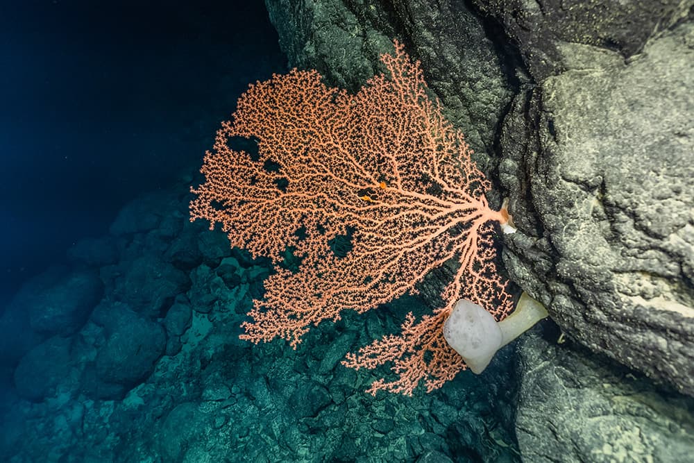
A primary objective of this expedition is to gather samples to determine the geologic origin and age of these seamounts as part of better understanding of the formation of the Northwestern Hawaiian Islands. These seamounts will also be surveyed for biodiversity. Scientists expect to find rich coral and sponge communities, which are commonly found on seamounts of these depths throughout PMNM.
Dual-Technology Seafloor Mapping in PMNM
Dates: July 16 – August 8, 2022
Lead Scientists: Dr. Larry Mayer, University of New Hampshire (at sea); Capt (RET) Andy Armstong, Joint Hydrographic Center (at sea); Dr. Randall Kosaki, Papahānaumokuākea Marine National Monument (ashore)
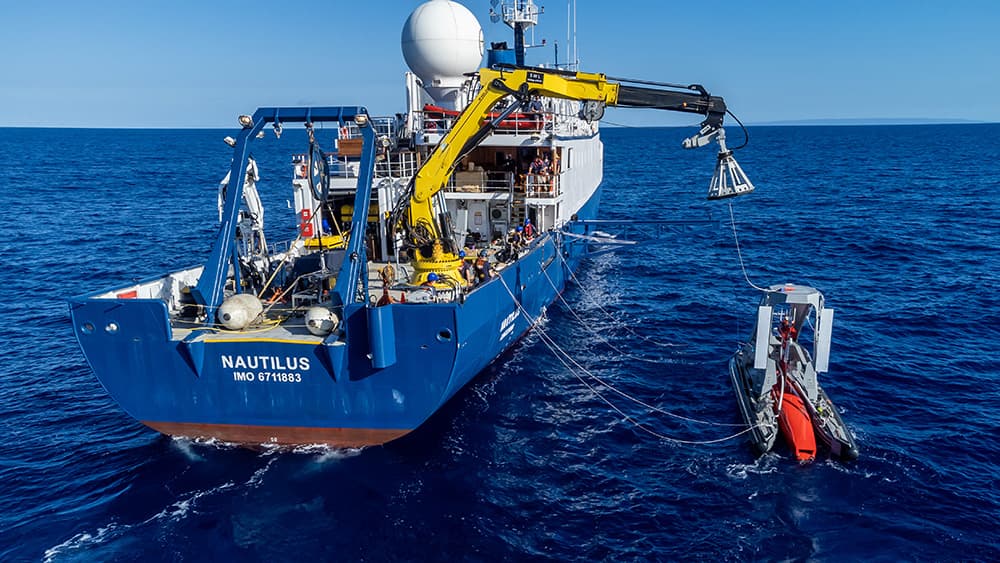
This expedition focuses on high-resolution mapping areas of Papahānaumokuākea Marine National Monument (PMNM) currently lacking data using ship-based mapping surveys in deep waters, as well as deploying the uncrewed surface vessel DriX for nearshore mapping. Acquiring this data will equip resource managers with a better understanding of the formation of deep-water and shallow-water terrain in the Northwestern Hawaiian Islands, contribute new data to nautical charts, and improve safe navigation in these areas. This expedition also contributes to the national and international goal of building high-resolution maps of the seafloor, especially in areas needing protection. This expedition will focus on the southern end of PMNM, between the islands of Nihoa and Pūhāhonu (Gardner Pinnacles).
From Shore to the Abyss
Dates: August 14 – October 16, 2022
Launching in 2022, the From Shore to the Abyss Program expands OET's ocean exploration program from the deep sea into coastal coral ecosystems lending their ship and research experience to contribute to new discoveries focused on the conservation of reefs and generation of new knowledge. The 2022 program will focus on the lower half of the Northwestern Hawaiian Islands within Papahānaumokuākea Marine National Monument—the largest marine protected area in the U.S. The areas surrounding many of the islands and atolls have not been mapped. Seafloor topography is fundamental to understanding the environment, as it lays the foundation for many other types of research.
Get involved in ocean exploration!
Bring the excitement of deep-sea exploration LIVE to your classroom, science center, museum, aquarium, or community event. Live ship-to-shore interactions with E/V Nautilus allow students to engage in a unique two-way, live Q&A with the educators, scientists, and engineers of the Corps of Exploration. Live interactions are available free to classroom and community events audiences. All live interactions are pre-scheduled to match your schedule.
Ship-to-shore interactions are conducted using Zoom or Google Meet and last 20 - 30 minutes with time for an expedition update and audience-led Q&A about careers, discoveries, or the exploration process. Schedule a program in English or in 'Ōlelo Hawaiʻi!
https://nautiluslive.org/education/ship-to-shore-interactions